TAKE ACTION, REDUCE WILDFIRES
In County and across the west, fires have grown larger and more destructive. Our communities need a coordinated, regional approach to manage fuels and protect people, ecosystems, and infrastructure.
The Wildfire Fuel Mapper was created to help landowners and managers in locating and understanding fire hazards on their land, providing users with a set of tools, resources, and information to help landowners and managers reduce fire hazards. The Wildfire Fuel Mapper can also be utilized by professionals to support their clients in planning vegetation management projects.
The Wildfire Fuel Mapper helps landowners and managers:
- Understand vegetation types and the need for fuel treatments
- Download best available information for properties and watersheds
- Connect with experts who can help plan and implement forest friendly fuel treatments
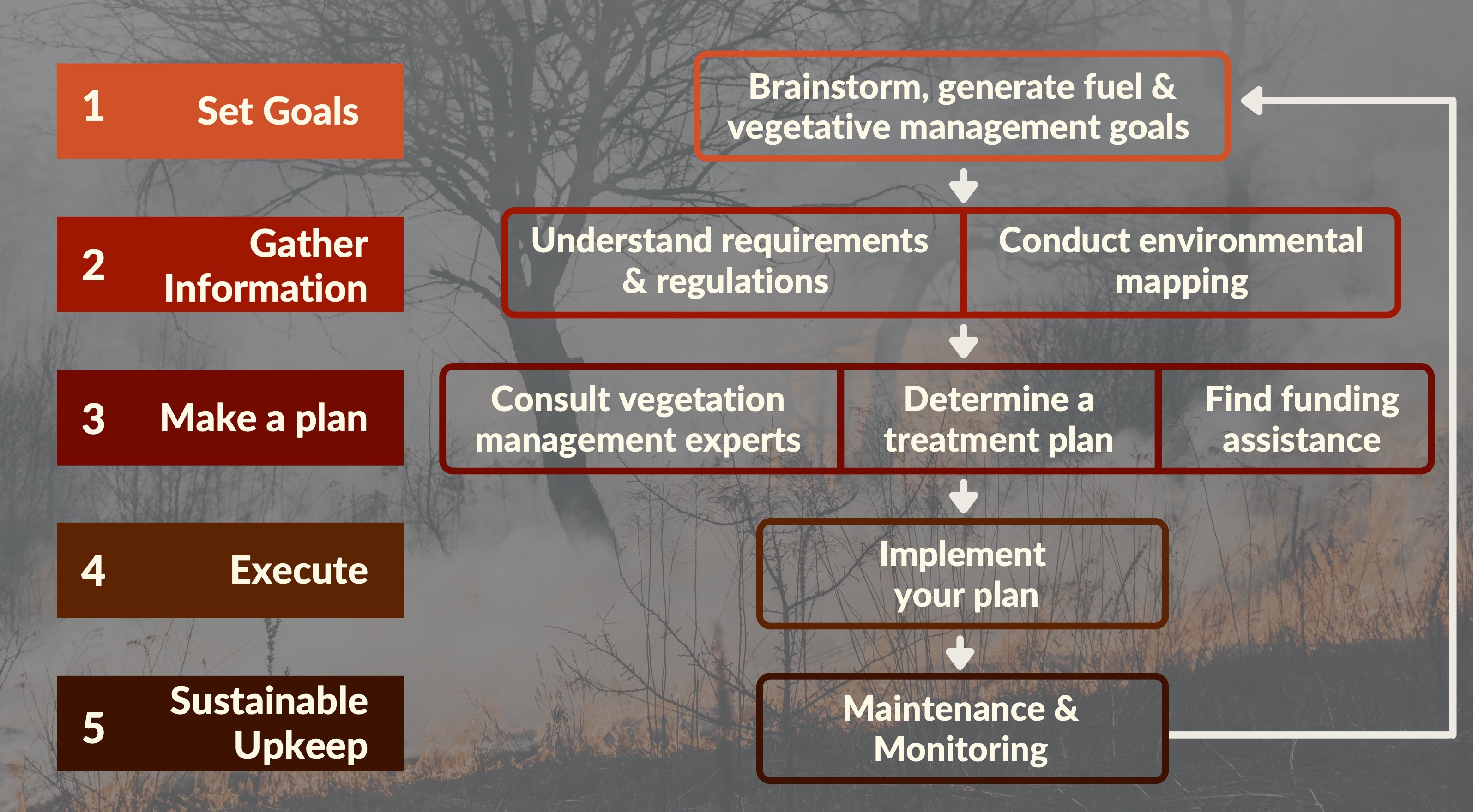
Vegetation management is designed to alter the amounts and arrangement of fuels that sustain wildfires. These actions have been shown to lead to fewer, smaller, and less damaging fires. You can take the next steps to implement a vegetation management plan and, together, we can support our region’s overall resilience to wildfire.